
Target
Epithermal gold and silver mineralization and porphyry copper and gold mineralization
Property Status
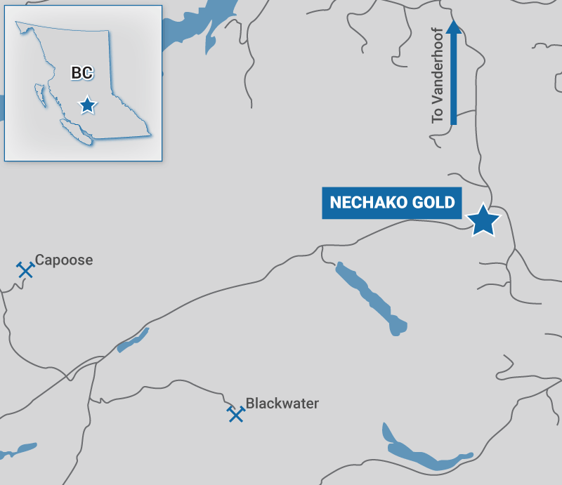
The Nechako Gold property comprises 10 mineral tenures totalling 2,975 hectares in the Nechako Plateau Region of central British Columbia. The property comprises two option agreement, Porphyry and Chutanli, under which Tower can acquire 100% interest in the property subject to a 1.5% NSR on each agreement.
Location
The road-accessible Nechako gold property is approximately 30 kilometres northeast of New Gold Inc.'s significant Blackwater development project. Blackwater contains a proven and probable total mineral reserve of 8.2 million ounces of gold with 60.8 million ounces of silver (source: New Gold Inc. website). The centre of the property is approximately 80 kilometres south of Vanderhoof, BC.
Geology and Historic Exploration
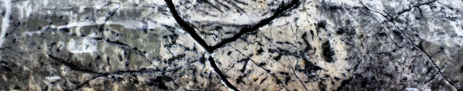
The Nechako Gold property is deemed prospective for Blackwater-type epithermal gold and silver mineralization and porphyry-related copper and gold mineralization. The property is underlain by rocks of the prospective Nechako Uplift which comprise volcanic, volcaniclastic, and siliclastic rocks of the lower to middle Jurassic Hazelton and middle to upper Jurassic Bowser Lake groups. These basement rocks are locally overlain by upper Cretaceous Kasalka group arc related volcanic rocks. The Jurassic to upper Cretaceous rocks are intruded by Jurassic, late Cretaceous and locally Eocene aged felsic plutons and plugs. The regional volcano-stratigraphy of the belt is dominantly striking to the northwest and is cut by high angle north to northeast trending normal faults. Most of the property is covered by a blanket of glacial till.
Historic exploration by Rio and Placer Dome, in the late 1960s and early 1990s respectively, outlined a near surface copper and gold porphyry system hosted near a contact between volcaniclastic rocks of the Kasalka group and a late Cretaceous monzonite plug. This mineralized area is historically known as the CH zone. Mineralization at the CH zone is interpreted, based on historic drill sections and geophysical data, to be open in most directions and at depth. Recent exploration programs consisting of induced polarization geophysical surveys, soil geochemical surveys, geological mapping and prospecting surveys and diamond drilling (2013 – Redhill Resources) coupled with regional till geochemical and airborne magnetic data (BCGS surveys and Geoscience BC data), outline a compelling epithermal gold and silver target located southeast of the CH zone.
2016 Exploration
In fall of 2016, Tower Resources initiated exploration efforts on the project with a systematic property-wide glacial till survey. Thirty-nine ~10 kg samples were collected in October 2016 by Overburden Drilling Management Limited (ODM) of Ottawa, Ontario. Of the 39 samples, 33 define a prominent gold grain anomaly at least 3.5 kilometres long by 2 kilometres wide; this till train is described by ODM as larger than the gold dispersal train from the Blackwater deposit (see Tower’s January 18, 2017 press release). As at Blackwater, this dispersal train is defined by high gold grain counts (up to 268 grains per sample), abundant associated garnet (up to 5000 grains per sample), and high gold concentrations in the silt fraction of the till (up to 120 ppb per sample).
The “background” gold concentration, defined by samples from the northwest portion of the survey area, is up to 10 gold grains per sample, comparable to that seen at Blackwater. Significantly, the rest of the till samples in the survey are anomalous in gold. This gold grain anomaly covers most of the property, with gold grain counts from 11 to 268 grains per sample.
The gold source is currently unexplained as known showings on the Nechako Gold property do not align with most of the dispersal train along paleo-ice direction. The source is inferred to be on the Nechako Gold property for several reasons: 1) many samples show a high percentage of pristine gold grains, unmodified by glacial transport; 2) the gold grain anomaly does not dissipate in a down-ice direction as expected from a distal source; and 3) the source area is limited by the presence of a large, post-mineralization pluton immediately up-ice from the property. Multiple gold sources are possible, given the size of the anomaly; the gold source(s) would not have been identified previously due to lack of outcrop and common post-glacial outwash deposits on the property.
2017 Exploration
Following-up on the 2016 gold-in-till results, Tower completed an Induced Polarization (IP) ground geophysical survey over the core target areas of the Nechako property in June of 2017. A previously untested, 1000m by 500m coincident chargeability and resistivity anomaly was identified under till cover 2km east of the CH zone. The newly delineated target is located within the core of the till anomaly, adjacent to a major through-going structure seen in regional airborne magnetics. The blind target is covered by a blanket of glacial till and has never been drill tested.
In response to the highly encouraging results from the 2017 IP survey and the significant 2016 gold-in-till sample results, Tower mobilized a Reverse Circulation (RC) rig to the property in late 2017 to sample till and test bedrock below till cover in priority target areas on the property. The RC program has been designed to both test bedrock within the newly identified geophysical anomaly and to further delineate the gold-grain-in-till anomaly.
Cautionary Statements
The technical contents of this website were reviewed by Christopher Leslie, M.Sc., P.Geo., VP Exploration and a Qualified Person as defined by National Instrument 43-101. The information provided in this website is provided solely for general knowledge purposes and may contain data historical in nature which has been compiled from sources believed to be accurate. The historical technical information has not been verified by Tower and may in some instances be unverifiable dependent on the existence of historical drill core, trench and grab samples. This website is not intended to be a comprehensive review of all matters and developments concerning the Company and the Company assumes no responsibility for its completeness, accuracy and currency. Although information used in this website is believed to be accurate as at the date hereof, it may not be accurate when read. The Company does not undertake to update any of the information provided in this website. For current information please refer to the Company's filings on SEDAR (www.sedar.com) or contact the Company